Who we are
Precise weather forecasts and personal consultation for safe decisions at sea and ashore.
Built on 27 years of experience.

METEO TRACKER
High-quality weather data, intelligent route finding and personal meteorological expertise. METEO TRACKER connects bridge, shore team and routers to plan safe routes and reduce voyage costs.
METEO TRACKER brings voyage planning, fleet information, automatic route finding and weather data together. Bridge, shore team and WetterWelt routers use one application to plan, share and assess routes throughout the voyage.
Receive planned routes, assess the weather and coordinate recommendations with the shore team and routers.
Plan and compare routes, distribute them to captains with little effort and keep the fleet in view.
Personally support vessels through Active Routing, continuously assess weather and routes and discuss changes directly.
THE CORE FUNCTIONS
Current positions, sailed tracks and planned voyages are shown in one view. Fleet teams can see where each vessel is and which voyage is scheduled next.
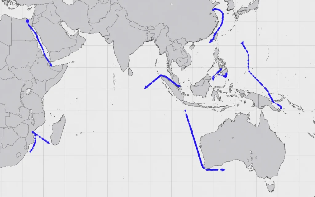
The algorithm accounts for vessel characteristics, draught, nautical requirements, weather data and bunker prices. The Route Network from Teledyne SevenCs provides the nautical data behind the calculation.
Nautical data source: Teledyne SevenCs Route Network
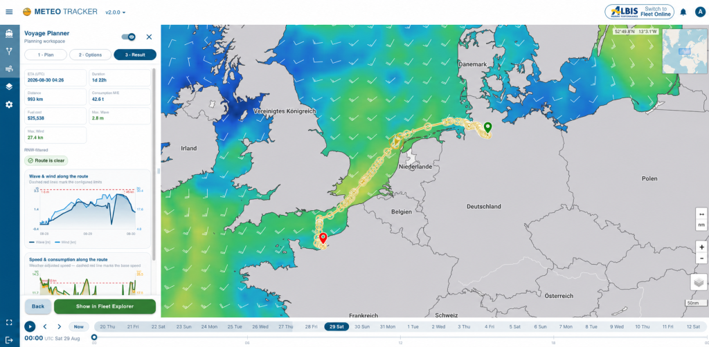
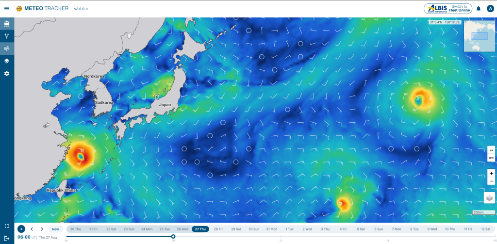
Wind, waves, currents and other weather data are shown on the chart. The captain can see the conditions expected on the next legs of the voyage.
ECONOMIC ROUTE PLANNING
Our own route-finding algorithm evaluates each leg at the time the vessel is expected to reach it. It accounts for weather, currents, vessel performance and nautical safety requirements. This helps reduce fuel costs, avoid weather-related delays and compare safe route alternatives. With Active Routing, our meteorologists add personal assessment and ongoing support.
Favourable currents increase speed over ground. Adverse currents and their effects on voyage time and consumption are included in the calculation.
Strength, height and direction affect every vessel differently. Vessel-specific speed profiles reveal where speed is lost and which alternative is more economical.
The algorithm considers the vessel’s consumption curve, current draft and different bunker prices inside and outside ECAs.
Safety depth, maximum draft, air draft, closed areas, traffic corridors and speed limits remain part of every calculated route.
METEO TRACKER calculates the route accordingly and reports ETA, consumption and fuel cost transparently.
The objective: optimise fuel consumption and cost while calculating a route suited to the vessel and voyage.
BRIDGE, SHORE TEAM AND ROUTING DESK
The office prepares and compares routes, shares them with the bridge and coordinates the voyage. During the passage, the captain keeps route and weather in view. When Active Routing is commissioned, our meteorologists provide ongoing assessment and direct support.
Calculate alternatives and compare voyage time and costs.
Share routes with captains and agree on the planning.
Track weather and route, with personal support when Active Routing is commissioned.
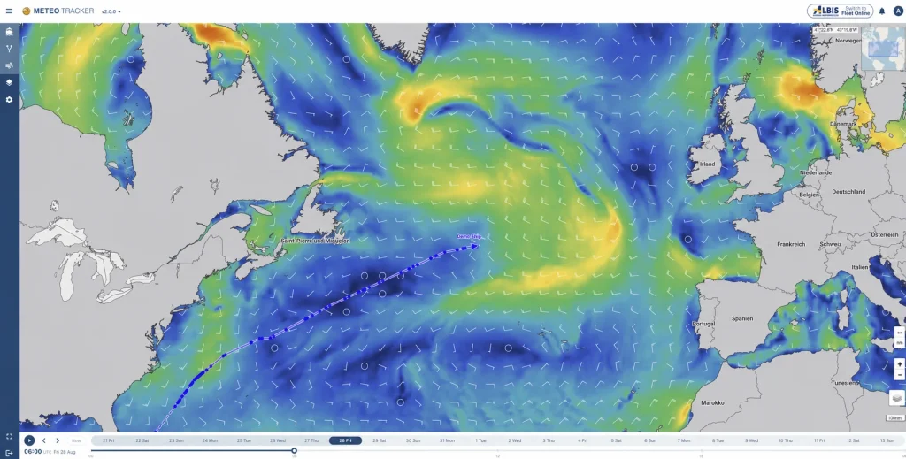
Example view: weather and route for planning onboard.

OPTIONAL ROUTING SERVICE
With Active Routing, our meteorologists personally support your voyage. They assess the developing weather and route together, discuss changes directly with the captain and shore team and support planning through to arrival. Particularly in heavy weather, automatic route finding is complemented by human experience and ongoing support.
The Anglo-Eastern Fleet Performance Cell ranks WetterWelt among the best weather-routing providers it works with – particularly for forecast accuracy and the professional, detailed advice given to captains.
EXPERIENCE METEO TRACKER LIVE
Arrange a meeting with us. We will discuss your vessels, users onboard and ashore, existing systems and integration requirements. Together, we will establish the next steps for METEO TRACKER and any personal routing support you need.
Or contact us directly at service@wetterwelt.net